


Snowy conditions are expected to continue following Storm Goretti, with forecasts indicating prolonged blizzards in the upcoming days. Storm Goretti caused disruptions across the UK as the Met Office released alerts for snow, ice, wind, and rain. A rare red warning for wind was issued in the south-west, where a tragic incident occurred as a man lost his life due to a falling tree on a caravan.
Recent weather models now predict additional snowfall post this weekend, with initial snowfall anticipated in parts of northern England and Scotland on January 18. The ECMWF model illustrates a significant weather system moving in from the Atlantic around 6 am, accompanied by heavy rainfall in various low-lying areas across the nation.
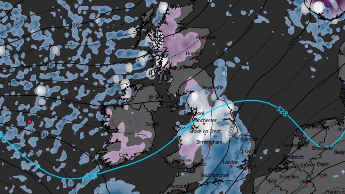
Further snowfall is projected for January 19, affecting regions such as the south-west of England, Wales, the Pennines, the Yorkshire Dales, and western Scotland. Data suggests that Scotland might experience snowfall at a rate of approximately four inches per hour in certain areas.
On January 20, even more snow is expected, particularly in the Midlands and northern England around 6 am. Cities like Manchester, Liverpool, and Stoke-on-Trent could witness snowfall, with the possibility of one-inch-per-hour flurries.
By midday on January 20, snow depth charts indicate that parts of northern Scotland could see up to 40cm (16 inches) of snow accumulation. Wales might expect around 7cm (three inches) while northern England could receive up to 6cm (two inches) of snow.
BBC Weather forecasters also suggest the likelihood of more snow later in the month. The forecast for the upcoming week indicates the potential for heavy rain and strong winds, with snow mainly forecasted for higher regions in northern Scotland.
Regarding the period from January 19 to 25, the forecast mentions a low chance of significant snowfall, with possible wintry showers in northern areas, primarily in Scotland, during colder and brighter intervals between weather patterns. For most regions, precipitation levels are expected to be normal or above normal, leading to a gradual melting of any remaining snow.
The Met Office has issued an amber snow warning effective today, lasting until 2 pm tomorrow in the Highlands. Additionally, three rain warnings were issued over the weekend for Scotland and Northern Ireland.
Met Office Chief Forecaster Rebekah Hicks highlighted that Sunday would bring disruptive weather as the UK transitions to a milder air mass. This transition is expected to result in notable snow accumulations in already affected areas of Scotland, with parts of the Highlands potentially seeing an additional 20-30cm of snow accompanied by strong winds.
The snow is forecasted to turn into rain throughout the day, with a possibility of freezing rain leading to hazardous icy conditions. The heavy rain and snowmelt, combined with rising temperatures, pose a risk of flooding in certain regions. With various severe weather warnings in place, staying updated with the forecast and information from local authorities is crucial.
Stay informed with the latest news by selecting Daily Mirror as a ‘Preferred Source’ on Google News for quick access to valued information.
At Reach and our affiliated entities, we and our partners use cookies and other identifiers to enhance site experience, analyze usage patterns, and provide personalized ads. You can opt out of data sharing by clicking the “Do Not Sell or Share my Data” button on the webpage. Please note that preferences are specific to each browser. By using our website and services, you agree to the use of cookies and consent to our Privacy Notice and Terms and Conditions.